-
Road Trip: Day 13
Posted on September 10th, 2012 No commentsYesterday I spent some time rethinking my drive for today. The original route put me through the middle of the Kootenai National Forest on a one-lane road (full of grizzly bears). I really wanted to drive on Highway 508, which has received awesome reviews from motorcyclists (Butler Motorcycle Maps, motorcycleroads.us, etc.), but with no Google Street View to verify the quality of the route, I didn’t know which way to go. Late last night, after doing as much homework as I could, I decided to just go for it and drive the road “blind”.
Spending two nights at the same hotel really saved me time this morning, as I didn’t need to pack-up all my stuff before heading out. When I hit the road the sun was still on it’s way up and it was having a difficult time getting through the clouds… as a result the temperatures were quite cool (I actually used the heater in the G8). The wind today was also a definite factor as I could feel it pushing my car around on the road. I’m really glad I swapped hoods, as the wind + 70mph speed limit + trucks would have made for a stressful day with the Carbon Fiber one.
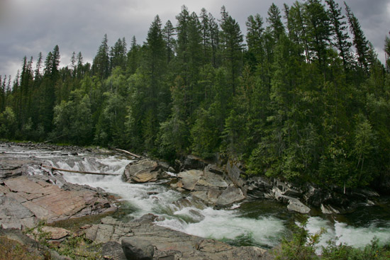
The road from Kaspelli to Libby was flowing and meandered through the countryside. After filling-up with gas I headed out towards the Yaak River Valley. I’m always on the lookout for scenic views, and just outside of Troy I pulled-over to check one out.

While I was stopped taking photos I was joined by two gentlemen on motorcycles who asked me if I had a map… Of course I have a map! Now… where did I put it? After digging through almost every bag in my trunk, I finally found my maps. The riders had the same questions about roads that I did last night, so I shared what I knew. I think we all agreed that Highway 508 would be worth the uncertainty. After a few more photos I headed back onto the road.

At this point I ventured into the unknown on Highway 508. While the first part of the road did not have a painted center-line, it was two cars wide. There were a few patches of gravel where they were repaving, but nothing was too rough (more dust than rocks). Part way through, and after a surprising left turn, the center-line appeared and I ventured “back to nature”. The route almost felt claustrophobic with the trees being so close to the sides of the road, but the drive was very enjoyable. There were a few “road not maintained for public travel” signs, but they wouldn’t detour me from driving the best part. The last few miles went up and over a ridge and included one hairpin turn after another… it was awesome!
Someplace during this part of the drive the G8 rolled-over 40,000 miles. Normally I’d have liked to photograph a milestone like this, but I think this drive was a much better activity!
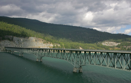
The rain held-off just long enough for me to finish driving Highway 508, but stuck around for the remainder of the afternoon. The last part of my day was driving on Highway 37 along the shore of Lake Koocanusa, and in addition to the sweeping curves (at 70mph in the rain) the views were spectacular.

Tomorrow I’m heading into Glacier National Park and the world famous Going-to-the-Sun Road. Hopefully doing this drive mid-week after Labor Day (but before the September 17th closure) will result in fewer people.


